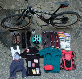
ORBIT360
In 2022 I participated at the orbit360. This is a series of so called self-contained stages for gravel bikes. Self-contained means you cannot take any support from third parties except those that can be appreciated by anyone, like buying in a grocery store or stay overnight at a hotel. Instead of riding with a gravel bike you may in fact take any type of bike, with no electric power though. I rode the orbits on a MTB hardtail; I do not own a gravel bike. And it would defintely not be my first choice, as some of the downhill sections are rough, and the single trails may tend to be a bit pumpy. The Switzerland series consists of 6 stages. In Germany there are even 18 stages. The stages are always circles, and you are allowed to start from any point of the track.
The following list contains the Swiss orbits I circled (click on it to see in Komoot or Garmin); alternatively click on the map of the summary view in the sidebar:
- #1: Cosmic Conjunction - Chasseral (Garmin)
- #2: Dust Detector - Jura (Garmin)
- #3: Planetary Path - Oberwallis (Garmin)
- #4: Engadine Eclipse - Engadin (Garmin)
- #5: Votec Velocity - Berner Oberland (Garmin)
- #6: Final Flare - Schwyz (Garmin Part 1 / Part 2)
Generally, the Swiss stages are quite tough with a tremendous elevation gain, mostly more than 4000m on each orbit. There is a scoring for finishing a stage, for total time required of the stage, plus you receive bonus points for finishing 3 and 6 stages. The stages need to be accomplished within a time window of a bit more than 2 months in the summer of 2022. After having finished an orbit, you need to upload the track to the platform komoot.de. It is in fact (also) useful for creating tracks for hiking and cycling for instance. Orbit360 then provides a ranking.
The 6 Swiss orbit360 stages are found here: link
Final ranking of the Swiss orbits
On the left hand side you find my tracks with all the detailed info at komoot.de; in fact, one agrees to make these tracks public anyways, when participating at the orbit360. If you click on the left the corresponding page on komoot.de opens with all the infos from my ride. Komoot translates the elevations in a strange manner. On a Garmin device (I have used an edge 830), and my personal training application on the Mac, the elevation gain numbers were quite different.
--------------------
My first stage was the Cosmic Conjunction - Chasseral. The night before I took the car and drove close to the track as this is only 80km away from Basel. I slept in the car, had breakfast and started at 5.15am (!). This is a very varied circle (orbit) with some nice single tracks before Vue des Alpes. Along the river Doubs, which is the border to France the track was very difficult and narrow. Definitely a MTB is the better choice, but I had to walk quite a bit as well. After nearly 20km along the river, there was quite a serious climb. Once on top, you need to open and close numerous cattle guards which made a flow quite impossible. After 11h 9min I was back in Corgémont, where I started, not too far away from Tavannes. I was satisfied and quite exhausted, as this orbit was quite challenging.
---------------------
The second stage, the Dust Detector - Jura, I did mid week, as on the weekend before it was 35C in Basel… I took the train before 5am from Basel and started the 180km-orbit just outside of Pratteln at 5.20am. For almost two hours there was drizzle. As for my first orbit the climbs were not as long as in the Alps. Often 400m-600m elevation, and lots of really small ones below 100m. Riding in the Alps is then very much different; see all the other orbits. After 69km or 4h 15min I went for groceries and a coffee yogurt drink, and again after 132km, 8h 50min (in Langenbruck). Even more than in the Chasseral orbit I became quite slow for the climbs towards the end, as I was very exhausted. Some 30 minutes before finish I was hit by a thunderstorm. Luckily, there was not too much rain and only hail for 30 seconds or so. At the finish of the orbit I was rolling an additional 10km very relaxed back home to Basel… I felt exhausted, but very satisfied, as this was my longest ride with a MTB (184km) ever, and with a personal record in elevation gain (the corrected elevation featured by Garmin connect showed more than 5000m; I guess it was around 4700m. The official one by orbit360/komoot.de was at around 4500m).
----------------------
The third stage, the Planetary Path - Oberwallis, is a classical route in Oberwallis (i.e. German speaking part of the canton of Wallis) with some well known stretches. I have stayed overnight in a hotel in Visp, the starting point. After the first climb of just 300m, the real big one of roughly 1800m to the dreaded Breithorn started after 15km. There are 14 180-turns which are also proclaimed at the known Stoneman Glaciara (in fact, I had planned to do the Stoneman Glaciara; but when I saw that the Orbit 360 does it in a similar way, I have chnaged my mind and planned for the planetary Path. The Stoneman shows a higher degree of single trails with technical sections as well; definitely a mountain bike, preferably with suspension, is the better choice). Eventually, the descent goes into the Binn-Tal. and another 800m climb starts from there and back into Binn. After some minor climbs and 95km a brutal climb of 1100m to the Aletsch area needs to be done. This is a real tough one. I became slow, at least it was not so steep (usually around 10% grading). Once on top there is no more significant climb for 34km. You lose 1500m of elevation, so I was able to achieve a 27km/h average on this last stretch. After 142km, 4400m of elevation and 10h 54min I was back in Visp. I enjoyed a huge ice cream, recovered a bit and took the train back home to Basel.
----------------------
One week later on 16 July 2022 I did my forth orbit, the Engadine Eclipse - Engadin. I rode this long and difficult orbit right on my first day of holidays in Val Müstair. So I started in Sta.Maria at 5.30am. Since I have spent quite some time in Engadin, I knew most of the stretches. After 100km I was at an average of almost 17km/h which was extremely good for me. But the following climbs, particularly the very last one to the Bocchetta di Pedenolo at 2750m, were very tough; on this last climb of the circle, the stones built a deep surface and this military trail from World War One was narrow in very steep slopes. So I often had to push the bike as it was too strenuous for me at this point of the orbit. The last stretch was the 1200m-descent on the road from the Umprail Pass. The Garmin device showed 185km, 4700m elevation and 13h 49min. I was literally toast now, but felt satisfied with my achievement.
----------------------
As I happen to be on holidays at the lake of Brienz right after the week in Val Müstair, I have planned to go for the Votec Velocity - Berner Oberland, my 5th orbit. This is a route with splendid views of the Berner Oberland as well as of the Bern and Thun region. The climb from Thun to Goldiwil and then to Sigriswil offers gorgeous views of the Thunersee. Technically, it is not a difficult track, but it is my longest distance I have done on a bike ever: 211km. The orbit yet becomes a bit difficult due to the total elavation gain. My garmin edge did some strange things, maybe also due to the changing pressure caused by possible thunderstorms. Anyways the total elevation is about 4500m, possibly a bit more.
----------------------
And finally my last orbit, i.e. number 6, the Final Flare- Schwyz which is truly a final flare… I was afraid of this orbit, of its elevation gain; nearly 5500m. Depending on the map provider and its computation method on the elevations, it may also be as as 6000m-ish… Anyway, as the weather was still good towards the end of the time window of the orbit360, I decided to do this orbit as an overnighter. So I started around 3pm and did the first 1600m to Urnerboden on day 1. I stayed overnight at the Gasthaus Urnerboden. Very good service! CHF 40 for a night in the multi-bed room (as in a mountain hut) incl. breakfast (but I was the only one, so in fact a one bed room). I then took off in the morning at 6.45am. These first hours in the morning I absoltely liked the most on all the orbits: cool, great light, absolutely nobody around, one feels strong (later in the day that disappeared…), and sometimes you see various animals (deer, fox, and once wild pigs). The ascent to the Fisetenpass was really great and very nice. Similary, the third major ascent to the Geissgraetli (highest point of the orbit at 2127m) was good, even though fairly steep towards the end. The descent began rough (as many descents for this orbit). After another 800m elevation I had a quick sandwich lunch in Schwyz, something like one of the historical centers of Switzerland, as the canton of Schwyz was one of the first three cantons. It followed the final Pragelpass, really steep, paved though; only the last 300m were on gravel again, towards the end even too steep and not ridable. Anyways, the descent to the starting point in Glarus was super easy, paved and no more ascents.